«الأرصاد»: أمطار رعدية ورياح مثيرة للأتربة على أجزاء من المملكة
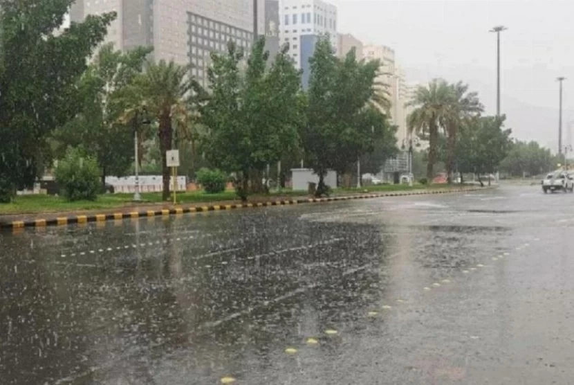
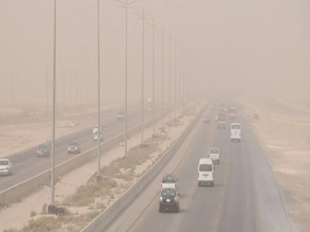
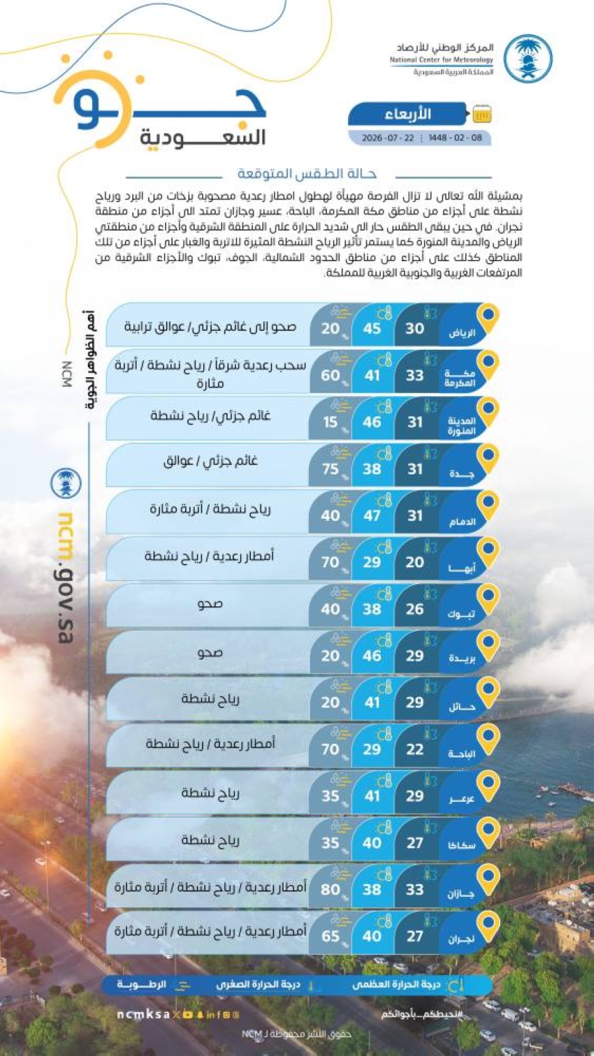
توقّع المركز الوطني للأرصاد في تقريره عن حالة الطقس اليوم (الأربعاء)، هطول أمطار رعدية مصحوبة بزخات من البرد ورياح نشطة على أجزاء من مناطق مكة المكرمة، والباحة، وعسير، وجازان تمتد إلى أجزاء من منطقة نجران، في حين يبقى الطقس حاراً إلى شديد الحرارة على المنطقة الشرقية وأجزاء من منطقتي الرياض والمدينة المنورة، ويستمر تأثير الرياح النشطة المثيرة للأتربة والغبار على أجزاء من تلك المناطق كذلك على أجزاء من مناطق الحدود الشمالية، والجوف، وتبوك والأجزاء الشرقية من المرتفعات الغربية والجنوبية الغربية للمم…
يتوقع المركز الوطني للأرصاد، في تقريره الصادر اليوم الأربعاء، تساقط أمطار رعدية يرافقها زخات برد ورياح نشطة على أجزاء من مناطق مكة المكرمة والباحة وعسير وجازان، وتمتد إلى أجزاء من نجران، فيما يستمر الطقس حارًا إلى شديد الحرارة في المنطقة الشرقية وأجزاء من الرياض والمدينة المنورة، كما تستمر الرياح النشطة المثيرة للأتربة والغبار في أجزاء من تلك المناطق وأجزاء من الحدود الشمالية والجوف وتبوك والأجزاء الشرقية من المرتفعات الغربية والجنوبية الغربية.
وتأتي هذه التوقعات في ظل استمرار تأثير الكتلة الهوائية الحارة على أجزاء من المملكة خلال فصل الصيف.
ويشير التقرير إلى أن الرياح السطحية على البحر الأحمر ستكون شمالية غربية إلى غربية على الجزء الشمالي، وشمالية غربية إلى جنوبية غربية على الجزء الأوسط بسرعة تتراوح بين 5 و45 كيلومترًا في الساعة، وجنوبية شرقية إلى جنوبية غربية بسرعة 12 إلى 34 كيلومترًا في الساعة، وقد تصل إلى 50 كيلومترًا مع ظهور السحب الرعدية الممطرة على الجزء الجنوبي، ويتراوح ارتفاع الموج بين متر ومترين في الجزء الشمالي، ومن متر إلى مترين يصل إلى أكثر من مترين ونصف خلال ساعات الصباح الأولى في الجزء الأوسط، ومن نصف متر إلى متر ونصف يصل إلى أكثر من مترين مع تكوّن السحب الرعدية على الجزء الجنوبي، وتكون حالة البحر خفيفًا إلى متوسط الموج وقد يصبح مائجًا في الجزء الأوسط مع تلك السحب.
فيما ستكون حركة الرياح على الخليج العربي شمالية غربية إلى شمالية شرقية بسرعة 15 - 30 كم/ساعة وارتفاع الموج من نصف المتر إلى متر ونصف وحالة البحر خفيف إلى متوسط الموج.
The National Center of Meteorology expected in its weather report today (Wednesday) that thunderstorms accompanied by hail and active winds will occur in parts of the Makkah, Al-Baha, Asir, and Jazan regions, extending to parts of the Najran region. Meanwhile, the weather will remain hot to very hot in the Eastern region and parts of the Riyadh and Madinah regions. The effects of active winds that stir up dust and sand will also continue in parts of those areas, as well as in parts of the Northern Borders, Al-Jawf, Tabuk, and the eastern parts of the western and southwestern highlands of the Kingdom.
The report indicated that the surface wind movement over the Red Sea will be northwesterly to westerly in the northern part and northwesterly to southwesterly in the central part at a speed of 5 - 45 km/h, and southeasterly to southwesterly at a speed of 12 - 34 km/h, reaching up to 50 km/h with the formation of thunderstorm clouds in the southern part. The wave height will range from one to two meters in the northern part, and from one to two meters, exceeding two and a half meters during the early morning hours in the central part, and from half a meter to one and a half meters, exceeding two meters with the formation of thunderstorm clouds in the southern part. The sea condition will be light to moderate waves, reaching choppy in the central part as well, with the formation of thunderstorm clouds in the southern part.
Meanwhile, the wind movement over the Arabian Gulf will be northwesterly to northeasterly at a speed of 15 - 30 km/h, with wave heights ranging from half a meter to one and a half meters, and the sea condition will be light to moderate waves.
وتشير التوقعات إلى احتمالية استمرار هذه الأجواء خلال الأيام المقبلة، خاصة مع نشاط الرياح الموسمية التي تؤثر على المرتفعات الجنوبية الغربية. ويُذكر أن الأمطار الرعدية في هذه المناطق غالبًا ما تؤدي إلى جريان السيول في الأودية، مما يستدعي أخذ الحيطة والحذر من قبل المواطنين والمقيمين.
المصدر الأصلي: عكاظ



التعليقات (0)
كن أول من يعلّق.