Geospatial Authority Launches Workshops on Regulating Land Survey Activities in the Kingdom
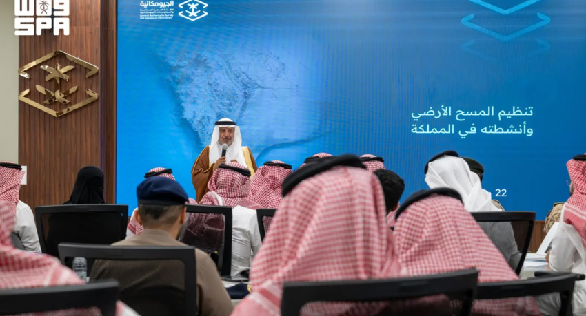
The General Authority for Survey and Geospatial Information has launched the first workshops on regulating land survey activities, in a step aimed at developing the regulatory framework for land surveying in the Kingdom, improving the quality of professional practices, enhancing the reliability of survey and geospatial work, supporting national development, elevating the quality of geospatial information, and keeping pace with the goals of Saudi Vision 2030.
The launch was attended by the President of the General Authority for Survey and Geospatial Information, Dr. Eng. Mohammed bin Yahya Al Sayel, and representatives from over 60 entities representing the government, private, and academic sectors, as well as a number of international experts. The authority reviewed the main features of regulating land survey activities in the Kingdom, which include organizing land survey work, developing professional frameworks for practitioners, and enhancing the application of technical and regulatory standards in line with international best practices.
In his opening speech, the President of the Geospatial Authority emphasized that land surveying forms the cornerstone upon which various development projects rely, serving as the starting point for infrastructure projects, urban planning, transportation networks, and investment projects. He pointed out that the quality of survey work directly impacts project quality, implementation efficiency, decision integrity, and spending efficiency. He stated that the unprecedented developmental boom the Kingdom is witnessing and the acceleration of major national project execution have reinforced the need to develop an integrated regulatory framework for land survey activities, unifying practices, raising quality levels, enhancing confidence in geospatial outputs, achieving integration between government entities and the private sector, and keeping pace with the Kingdom's aspirations for leadership in the geospatial sector. During the workshop, the authority presented concepts of land surveying, its types, methodologies, and the most prominent modern technologies used in survey and geospatial work, while also emphasizing the importance of unifying technical practices and adopting the national spatial reference to ensure the accuracy and reliability of geospatial information and enhance its integration at the national level.
The authority also addressed the role of the National Geospatial Academy in building national capacities, implementing specialized qualification programs for land survey activities, and enhancing the readiness of practitioners according to best practices and professional standards, thereby improving the efficiency of cadres in the geospatial sector. The workshops on regulating land survey activities in the Kingdom are an extension of the authority's role, under its mandate, to regulate the survey and geospatial information sector and related imaging, set standards and controls, build an integrated regulatory system based on governance, unify technical standards, regulate practice, raise the efficiency of national cadres, and adopt modern technologies; thus ensuring the provision of accurate and reliable geospatial information that supports development, enhances investment, contributes to raising the efficiency of national projects, and establishes quality practices in the sector.
Original source: Al-Madina


Comments (0)
Be the first to comment.